1896 Redmond Road, Saint-Gabriel West
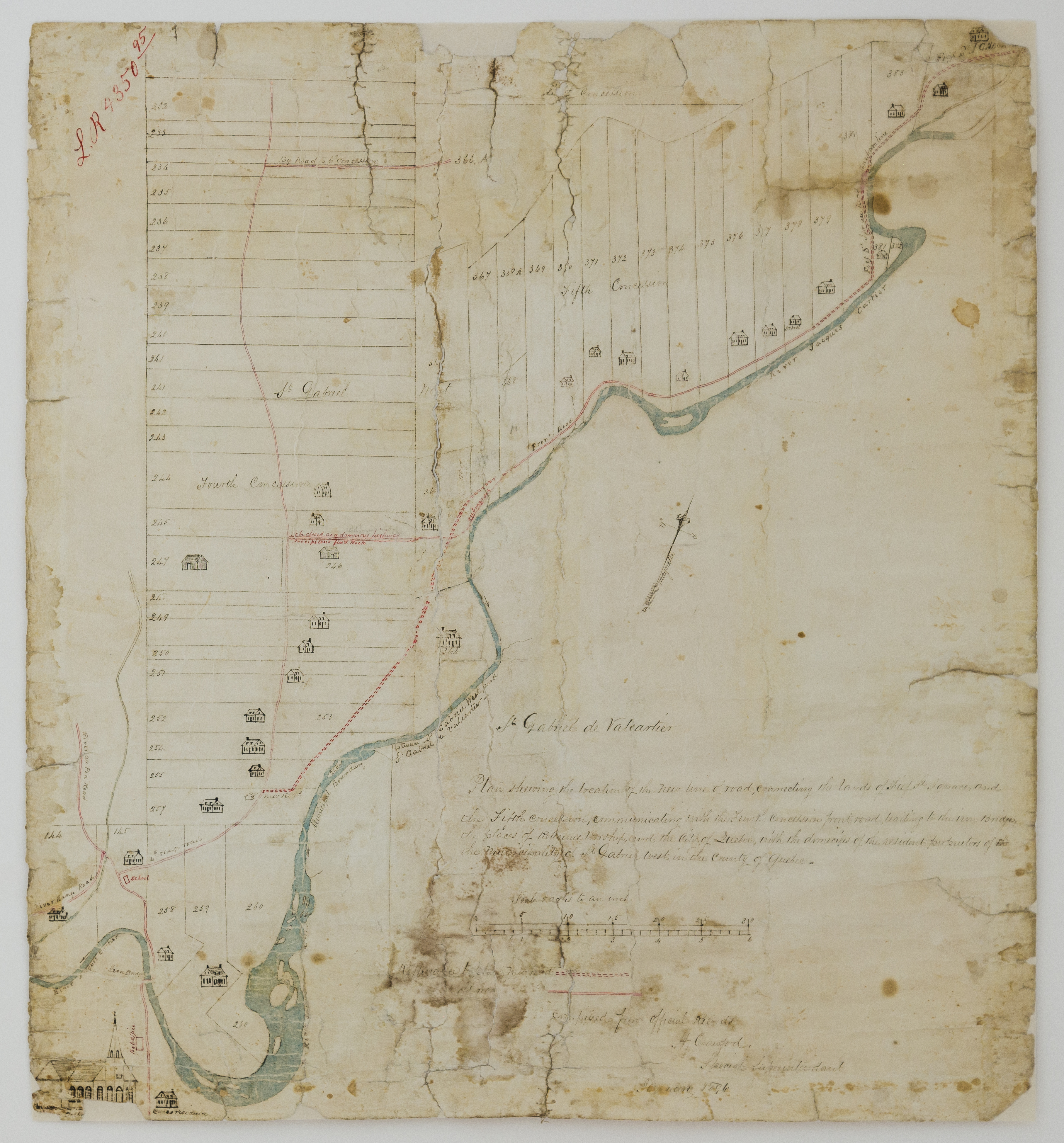
"St Gabriel de Valcartier
Plan showing the location of the new line of road connecting the lands of Fief St. Ignace, and the Fifth concession, communicating with the Fourth concession front road leading to the Iron Bridge, the places of Religious worship and the City of Quebec, with the domiciles of the residents proprietors of the Municipality of St. Gabriel West, in the County of Quebec.
Scale 5 acres to an inch
Utterance to plan new road =========
Old road ___________
Compiled from official Records
H. Crawford
Special Superintendant
January 1896"
This road became what is now Redmond Road.
Carte de H. Crawford, datant de 1896 montrant la projection d'un nouveau tracé d'une partie de chemin évitant un ancien tracé jugé dangereux, à Saint-Gabriel West. Cette route devint le Chemin Redmond d'aujourd'hui.
Nouveau tracé =======
Ancien chemin ___________